
3·
4 days agoMany never find out. And not always because they’re actually the normal ones.
Many never find out. And not always because they’re actually the normal ones.

Cubism. Just to convince people it’s not about designing things any 5yo can build in Minecraft.

Human rights organizations and many high-profile news outlets have reported on this. See citations in the relevant Wikipedia article section. Reuters even has an article with video evidence.
That said, Hamas does this too and their surrender is probably the best we could hope for to further peace talks.
Yeah but Israel is also known to use Palestinian civilians as human shields, such as when crossing a suspected minefield.

It could have been a top Lemmy app if open sourced…

They can produce an unlimited number of CGI challenges and know what is correct. Collecting the AI training data from users only makes sense for classifying images from the real world. Even then, Google’s reCaptcha checks if you’re consistent with other users so you’re unlikely to pass with a random answer.
There’s Bluetooth and USB (with Ghirehtet over ADB or external wireless/Ethernet card) that you can use to make a Wi-Fi internet hotspot without mobile data. Also, you could NOT connect to the internet and use LAN-based apps (KDE Connect, network printers) without extra hardware in a pinch, or just broadcast an SSID in a public space for fun.
Never lived up to the hype. Take almost as much effort to get ready for another flight as building another one.
all taxpayer money anyway
Yes but with very little to show for it. If the government just treated all undelivered orders as debt, it would end up deep in the red.
♪ MSN
♪ MSN
♪ Who said MSN?
♪ If you go on MSN
♪ A terrible thing will happen to you
♪ You will sit and stare for hours
♪ And people you don’t like will talk to you
♪ Don’t go on MSN
♪ Don’t go on MSN
♪ Don’t go on MSN
♪ Don’t go on MSN

I’m surprised Nintendo hasn’t patented CRT shaders so they can sell them as a Switch 2 exclusive. (They are but luckily we know about the alternatives)

Trump’s krypto nite?

The other comments are correct. Also, a solenoid that switches another set of contacts is called a relay, or contactor.
We’ve known for a while that he only cares if they’re about him. The CIA is running out of ideas to shoehorn his name into the text.
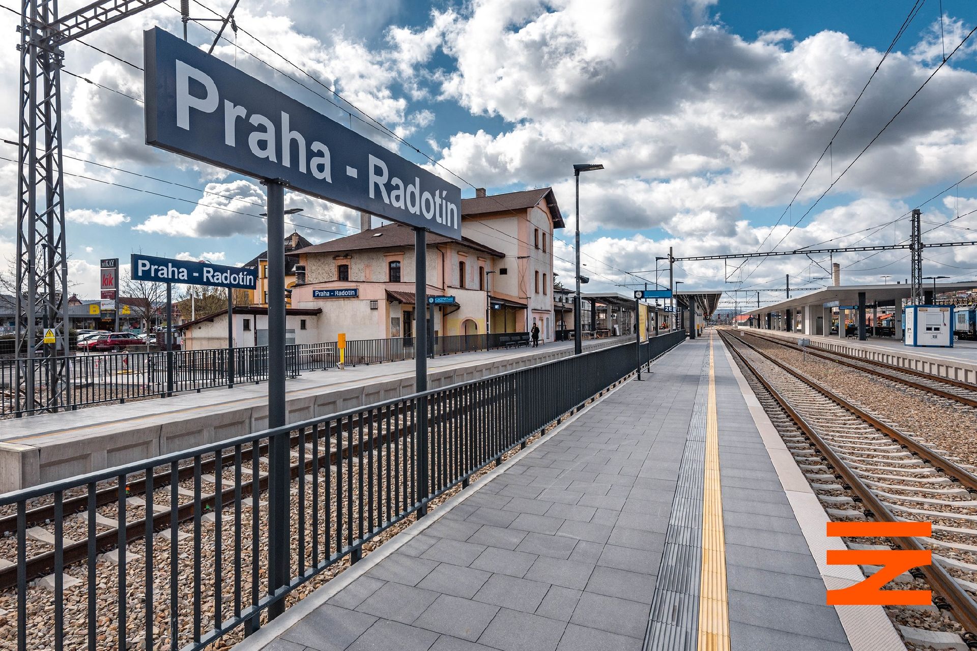
What do you mean, Edinburgh? The city in question is Prague. See the console brand, it’s from Prague 16 (Radotín).
Edit: /s
BTW the Czechoslovak electronics brand TESLA also made a crappy Pong console using a presumably stolen chip design.
Mmm… realistic
Reddit as in the company? Of course, the first Reddit search result has been manually set to a “Stay away from Lemmy” post.
Probably a habit from the dark ages: there is an entire generation (15 years if you were rich in 1998 and poor in 2013) of phones where SMS is the longest freeform text storage available, and only 1 draft can exist at a time, hence the sending.